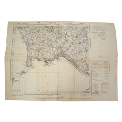
Genuine WWII British map, Isernia, Second Edition, Sheet 161, scale 1:100,000.
This map covers a large area around the town of Isernia, Molise, Southern Italy.
Edited by the General Staff-Geographical Section of the War Office in 1943. Dimensions: 20in x 22.4in.
Quite good overall condition; the following mention has been written on the right side: Richard Wagner 504 Prcht Inf.
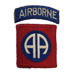
This annotation indicates that the present map may have belonged to Richard R. Wagner, Regimental Headquarters, 504th Parachute Infantry Regiment, 82nd Airborne Division.
You might also like
Genuine WWII British map, Isernia, Second Edition, Sheet 161, scale 1:100,000.
This map covers a large area around the town of Isernia, Molise, Southern Italy.
Edited by the General Staff-Geographical Section of the War Office in 1943. Dimensions: 20in x 22.4in.
Quite good overall condition; the following mention has been written on the right side: Richard Wagner 504 Prcht Inf.
This annotation indicates that the present map may have belonged to Richard R. Wagner, Regimental Headquarters, 504th Parachute Infantry Regiment, 82nd Airborne Division.