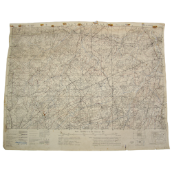
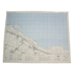
Rare genuine WWII British map, Thaon, Edition of Jun. 1943, Sheet No. 37/16 N.E., scale 1:25,000.
This map covers a large perimeter of both the Bessin and the Plaine de Caen, in Normandy, which includes the towns of Putot-en-Bessin, Bretteville-l'Orgueilleuse, Rots, Authie and Buron.
In June 1944 the entire area was the theater of fierce fighting between the British and Canadian forces on one side (particularly the 3rd Canadian Infantry Division), and the German forces on the other -- including the 12. ᛋᛋ-Panzerdivision „Hitlerjugend".
Edited by the General Staff-Geographical Section of the War Office.
Very good overall condition. Dimensions: 19.5in x 24.4in.
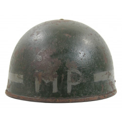
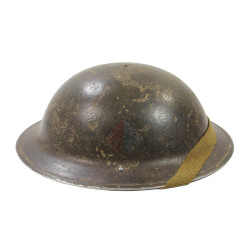
You might also like
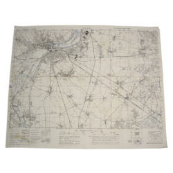
Rare genuine WWII British map, Thaon, Edition of Jun. 1943, Sheet No. 37/16 N.E., scale 1:25,000.
This map covers a large perimeter of both the Bessin and the Plaine de Caen, in Normandy, which includes the towns of Putot-en-Bessin, Bretteville-l'Orgueilleuse, Rots, Authie and Buron.
In June 1944 the entire area was the theater of fierce fighting between the British and Canadian forces on one side (particularly the 3rd Canadian Infantry Division), and the German forces on the other -- including the 12. ᛋᛋ-Panzerdivision „Hitlerjugend".
Edited by the General Staff-Geographical Section of the War Office.
Very good overall condition. Dimensions: 19.5in x 24.4in.