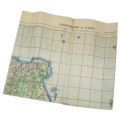
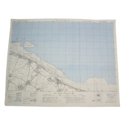
Rare genuine WWII British map, Barneville, Edition of September 1943, Sheet No. 28/18 N.E., scale 1:25,000.
This particular map features additional mentions: Defences - Information as at May 44 - Top Secret until issued for briefing ground troops; thereafter Secret. Known German defensive positions are shown on the map.
This map covers a large perimeter of the Western Coast of the Cotentin Peninsula, Normandy, France, which includes the towns of Barneville and Carteret, respectively liberated on June 18 and 19, 1944 by elements of the 9th US Infantry Division.
Edited by the General Staff-Geographical Section of the War Office in May 1944.
Quite good, used condition. Dimensions: 21.4in. x 24.4in.
You might also like
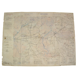
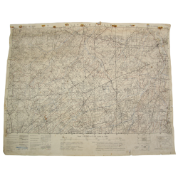
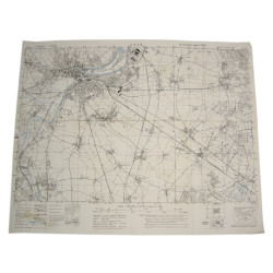
Rare genuine WWII British map, Barneville, Edition of September 1943, Sheet No. 28/18 N.E., scale 1:25,000.
This particular map features additional mentions: Defences - Information as at May 44 - Top Secret until issued for briefing ground troops; thereafter Secret. Known German defensive positions are shown on the map.
This map covers a large perimeter of the Western Coast of the Cotentin Peninsula, Normandy, France, which includes the towns of Barneville and Carteret, respectively liberated on June 18 and 19, 1944 by elements of the 9th US Infantry Division.
Edited by the General Staff-Geographical Section of the War Office in May 1944.
Quite good, used condition. Dimensions: 21.4in. x 24.4in.