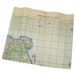
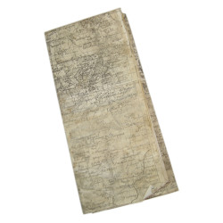
Rare genuine WWII British map, St Hilaire, Edition of February 1944, Sheet No. 34/10 S.W., scale 1:25,000.
This map covers a large perimeter north of the town of Saint Hilaire du Harcouet, Cotentin Peninsula, Normandy, France, which was liberated by elements of the 90th Infantry Division on August 2, 1944.
Edited by the General Staff-Geographical Section of the War Office in March 1944.
Quite good overall condition. Dimensions: 19.5in. x 24.4in.
You might also like
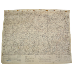
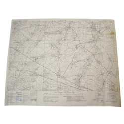
Rare genuine WWII British map, St Hilaire, Edition of February 1944, Sheet No. 34/10 S.W., scale 1:25,000.
This map covers a large perimeter north of the town of Saint Hilaire du Harcouet, Cotentin Peninsula, Normandy, France, which was liberated by elements of the 90th Infantry Division on August 2, 1944.
Edited by the General Staff-Geographical Section of the War Office in March 1944.
Quite good overall condition. Dimensions: 19.5in. x 24.4in.