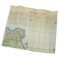
Rare genuine WWII British map, É, Edition of Aug. 1943, Sheet No. 40/16 N.E., scale 1:25,000.
The present map covers a section of the 6th British Airborne Division sector -- Merville-Franceville-Plage, Bavent, Dozulé, Gonneville-sur-Mer...
Edited by the General Staff-Geographical Section of the War Office.
Very good overall condition. Dimensions: 19.6in x 24.4in.
You might also like
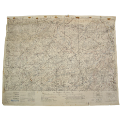
Rare genuine WWII British map, É, Edition of Aug. 1943, Sheet No. 40/16 N.E., scale 1:25,000.
The present map covers a section of the 6th British Airborne Division sector -- Merville-Franceville-Plage, Bavent, Dozulé, Gonneville-sur-Mer...
Edited by the General Staff-Geographical Section of the War Office.
Very good overall condition. Dimensions: 19.6in x 24.4in.