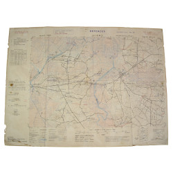
Extremely rare genuine WWII British invasion booklet, Invade Mecum, Volume 4.
This atlas of Normandy covers its five actual départements (Manche, Calvados, Seine-Inférieure, Orne, Eure) along with two bordering départements (Eure-et-Loir and Mayenne). A true 'travel guide', this map book provides valuable information about the region's topography, industry, communication network and administrative division.
Edited by the British intelligence services, this precious document, based on the 1939 Michelin Guide and various geographical maps from the 1943-1944 period, was issued to Allied officers prior to Operation Overlord.
Complete and in very good overall condition.
You might also like
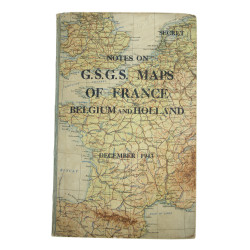
Extremely rare genuine WWII British invasion booklet, Invade Mecum, Volume 4.
This atlas of Normandy covers its five actual départements (Manche, Calvados, Seine-Inférieure, Orne, Eure) along with two bordering départements (Eure-et-Loir and Mayenne). A true 'travel guide', this map book provides valuable information about the region's topography, industry, communication network and administrative division.
Edited by the British intelligence services, this precious document, based on the 1939 Michelin Guide and various geographical maps from the 1943-1944 period, was issued to Allied officers prior to Operation Overlord.
Complete and in very good overall condition.