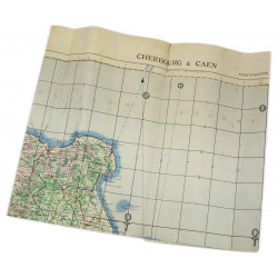
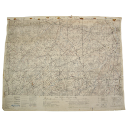
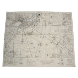
Rare genuine WWII Allied map, Gavray, FEdition of August 1943, Sheet No. 31/14 S.E., scale 1:25,000.
Edited by the General Staff-Geographical Section of the British War Office, the present map covers a large perimeter around the town of Gavray, Normandy, France, area of combat zone of the 2nd & 3rd Armored Division against the 2nd Panzer SS and the 17th Panzer SS Division.
Quite good overall condition.
Dimensions: 21.6in x 31.2in.
You might also like
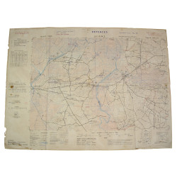
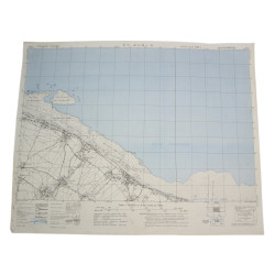
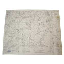
Rare genuine WWII Allied map, Gavray, FEdition of August 1943, Sheet No. 31/14 S.E., scale 1:25,000.
Edited by the General Staff-Geographical Section of the British War Office, the present map covers a large perimeter around the town of Gavray, Normandy, France, area of combat zone of the 2nd & 3rd Armored Division against the 2nd Panzer SS and the 17th Panzer SS Division.
Quite good overall condition.
Dimensions: 21.6in x 31.2in.