Map, Allied, Havre de Portbail, Normandy, 1943, 9th, 79th & 90th Infantry Division
  • Map, Allied, Havre de Portbail, Normandy, 1943, 9th, 79th & 90th Infantry Division
  • Map, Allied, Havre de Portbail, Normandy, 1943, 9th, 79th & 90th Infantry Division
  • Map, Allied, Havre de Portbail, Normandy, 1943, 9th, 79th & 90th Infantry Division
  • Map, Allied, Havre de Portbail, Normandy, 1943, 9th, 79th & 90th Infantry Division
  • Map, Allied, Havre de Portbail, Normandy, 1943, 9th, 79th & 90th Infantry Division
  • Map, Allied, Havre de Portbail, Normandy, 1943, 9th, 79th & 90th Infantry Division
  • Map, Allied, Havre de Portbail, Normandy, 1943, 9th, 79th & 90th Infantry Division
  • Map, Allied, Havre de Portbail, Normandy, 1943, 9th, 79th & 90th Infantry Division
  • Map, Allied, Havre de Portbail, Normandy, 1943, 9th, 79th & 90th Infantry Division
  • Map, Allied, Havre de Portbail, Normandy, 1943, 9th, 79th & 90th Infantry Division
  • Map, Allied, Havre de Portbail, Normandy, 1943, 9th, 79th & 90th Infantry Division

Map, Allied, Havre de Portbail, Normandy, 1943, 9th, 79th & 90th Infantry Division

€145.00
Tax included

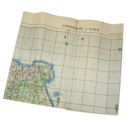
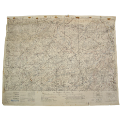
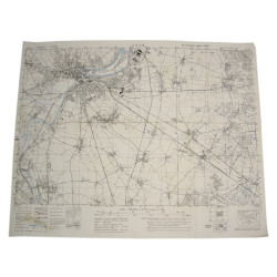
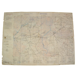
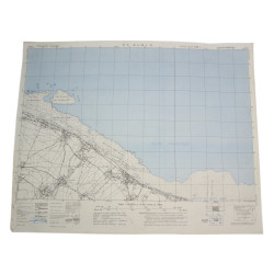
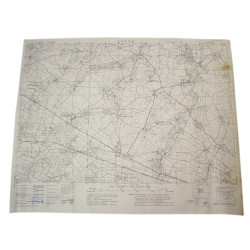
Rare genuine WWII Allied map, Havre de Portbail, Edition of August 1943, Sheet No. 28/18 S.E., scale 1:25,000.

Edited by the General Staff-Geographical Section of the British War Office, the present map covers the coast between Portbail and Surville. 

Quite good overall condition.

Dimensions: 19.6in x 24.4in.

Quantity

You might also like